
Water Street, undated possibly 1930’s

Water Street, Sept 8, 2013
In honor of Charter Day, Oct. 26, 2013 and an emphasis on Port Royal’s early history, this article looks at Port Royal almost 300 years later.
During the Great Depression of the 1930s, the federal government, through the Works Progress Administration (WPA) established federal art, music, theater and writers’ projects to provide relief jobs for unemployed artists, musicians, actors, and professional workers.
The Virginia Writers Project helped to document historical homes and properties. Today, the Virginia Historical Inventory (VHI) at the Library of Virginia is a collection of photographs, maps, and detailed reports documenting the architectural, cultural, and family histories of thousands of 18th- and 19th-century buildings in communities across Virginia. Many of these early structures do not survive today.
The collection consists of more than 19,300 survey reports (consisting of approximately 70,000 pages), more than 6,200 photographs, and 103 annotated county and city maps.
Here is their report on the town of Port Royal.
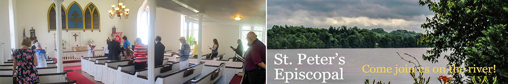
This article will explore properties other than St. Peter’s.
We have already collected St Peter’s items:
1. Historic Pictures of St. Peter’s ( Pictures)
2. WPA Inventory, 1938 St. Peter’s (Descriptions)
3. WPA Inventory, 1938 Rectory (Descriptions)
One name associated with this area was Selma Farmer who both photographed and wrote inventories of historic homes such as Gaymont, Prospect Hill during the 1930’s. She was also in Port Royal and wrote up St. Peter’s above as well as a number of local homes.
We will look at 13 homes in the 1930’s and what they look like today if they still exist. A house report researched by the Virginia Writers Project is included at the end of each home.
1 Corner of Market and Caroline (Mrs. C. P. Roach) (before 1837)


Building date: Before 1837
Building plan: L shaped
Number of stories: 1.5
Building material: Frame
Location: Port Royal, Va. on the corner of Market and Caroline Streets
Primary owners: John Pearson, William F. Owens, Mrs. C.P. Roach
Includes description and synopsis of letters related to the Pearson family dating back to the early 19th century.
This house was demolished in 1977 (Hidden Village – Ralph Fall)
2. Dr. Urquhart’s home (1786)


"Old Gravatt Place"
Map location number: CARO242
Building date: ca. 1780
Building material: Frame
3. River Hill (Riverview)


Building date: 1830-1836
Builder: John B. Lightfoot
Building plan: Square
Number of stories: 2
Building material: Frame
Location: Port Royal, Va.
Primary owners: John B. Lightfoot
Historical significance: Confederate Captain Sally Tompkins was a resident of this home. She ran a private hospitial during the Civil War.
4. Quesenbery


Building date: ca. 1750
Building plan: Rectangular
Number of stories: 1.5
Building material: Frame
Location: Port Royal, Va.
Primary owners: Quesenberry family, D.B. and Ruth Powers
5. Pratt Home


Demolished in 1979 (Hidden Village – Ralph Fall)
Number of stories: 1.5
Building material: Frame
Location: Corner of Cumberland and King Streets in Port Royal, Va.
Primary owners: Louise Thornton, Henriette Pratt, John Krause
6. Cottage


Above pictures. Slightly earlier than the period and not taken with the WPA. Frances Benjamin Johnston 1927-1929. Below in 2013

WPA pictures


Much of the property is surrounded by growth. Here is an approximate view in 2013:

Building date: late 18th century
Building plan: Rectangular
Number of stories: 1.5
Building material: Frame
Location: Port Royal, Va.
Primary owners: Sarah Bookenbrough, Cooper family, Maynard O. Gibbs
Also known as: Old Cooper’s Place
7. Townfield


Class: Home
Building date: 1714
Building plan: T shaped
Number of stories: 1.5
Building material: Frame
Location: Port Royal, Va.
Primary owners: W.T. Pratt, Constantine Brown
Historical significance: This home served as the British Headquarters during the Revolutionary War. During the Civil War, a cannon was shot through the drawing room.
Includes description of the house, smoke house and a small family grave yard.
Includes transcription of the tombstones of Catherine Gilchrist, Robert Gilchrist, and Sally Lightfoot.
8. Brockenbrough


Class: Home
Building date: ca. 1700
Building plan: L shaped
Number of stories: 2
Building material: Frame
Location: King Street, Port Royal, Va.
Primary owners: Brockenborough family, Peytons family, Clarence F. Hicks
This home at one time may have been an old tavern.
9. Catlett Home


Class: Home
Building date: ca. 1751
Builder: Unknown
Building plan: Rectangular
Number of stories: 1.5
Building material: Frame
Location: King Street, Port Royal, Va.
Primary owners: Catlett family, Robert Farni
10 Gouldin Home – Lot 61

Home is no longer in existence
Map location number: CARO268 Class: Home
Building date: ca. 1740 Building plan: Rectangular
Number of stories: 2 Building material: Frame and brick
Location: King Street in Port Royal, Va.
Primary owners: Joe Lampkin, Jim Thorton, Pryor family, Jim Gouldin
Historical significance: A Civil War skirmish was fought near the home. During the fighting the house’s portches were destroyed. One of the owners of this home, Joe Lampkin, was a slave trader. Jim Thorton was an African-American who ran a ferry, and ferried John Wilks Booth on April 24, 1865.
11 Marsten Home


Map location number: CARO246
Class: Home
Building date: 1759
Building plan: Rectangular
Number of stories: 4
Building material: Frame
Location: King Street, Port Royal, Va.
Primary owners: C.B. Thorton, Marsten family, Powers family
12 Port Royal Tavern


Survey report, Mr. Willie Farish’s home : 1937 Mar. 26 / research made by Selma Farmer.
Other Title Mister Willie Farish’s home
Material 4 leaves.
Gen. note Map location number: CARO274
Class: Home
Building date: 1856
Builder: Robert and Peter Catlett
Building plan: Rectangular
Number of stories: 2.5
Building material: Frame
House report
13 Powers/Holloway

This location is the parking lot of Memorial Baptist Church . Ralph Fall calls this the Gray-Thornton home on Lot 20. He noted in 1981 that it had been unoccupied for 25 years and "is now in such as ruinous condition as no longer to be salvaged."
Map location number: CARO272
Class: Home
Building date: ca. 1750
Building plan: Rectangular
Number of stories: 3
Building material: Frame
Location: Port Royal, Va.
Primary owners: Mr. Gray, Mr. Pendleton, Mr. Thornton, Mrs. Rosena Halloway
Historical significance: This house was damaged by gun boats on the Rappahannock River during the Civil War.